21
Jan
Create Amazing 3D Animated Maps!
Written by on .
I am especially excited about this next feature announcement. Blender artist and now OpenShot contributor Gwen Bulleryahen worked with the OpenShot team to bring this feature to life: Animated World Maps!
How does it work? Simply put, it let's the user enter a few basic parameters, such as the latitude and longitude of anywhere on earth to anywhere else on earth, and renders a beautiful animated line between the 2 points. This effect is often used on television and movies, and is very effective at showing the distance traveled between 2 far away places.
To create an animated world map, you launch the "Animated Titles" screen in OpenShot, and select "World Map" from the list of animations. You will need to look up the coordinates of your 2 locations using a web browser, Atlas, Google Earth, or any other resource that has coordinates. Only 1 map texture image is included by default, but it's easy to point to other map images. You can find all sorts of equirectangular projection images on the Internet, if you do not like the default one. The rest of the settings are relatively easy to understand, such as the color, the text of the labels, etc...
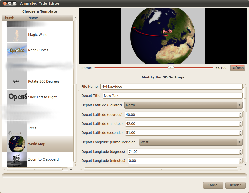
[The World Map editor - available on the Animated Titles screen]
Behind the scenes, OpenShot uses all sorts of fun math to calculate the angles, rotations, camera movement, X, Y, and Z coordinates of many different objects, all based on the latitude and longitude entered by the user. These numbers are then passed into Blender using the Python API of Blender 2.5.6+, and the rest is history!
If you want to hear OpenShot news before anyone else, be sure to join our Facebook page or subscribe to our RSS feed. Enjoy!